
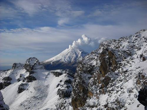
Επίσκεψη στο Popocatepetl
Χρήσιμες πληροφορίες για το κέντρο που θα σας βοηθήσουν να προγραμματίσετε το ταξίδι σας στο %{resort_name}
- Εναρξη σεζόν—
- Λήξη Σεζόν—
- Διαμονή—
- Εστιατόρια | Μπαρ— | —
- Κοντινότερο Αεροδρόμιο Mexico City
- Κοντινότερο τρένο —
- Iστοσελίδα—
- Τηλέφωνο εξυπηρέτησης—
Παροχές στο Popocatepetl
Η έκταση στο Popocatepetl περιλαμβάνει:
- Halfpipes—
- Πάρκα—
- Cross Country—
- Ενοικίαση Εξοπλισμού Σκι—
What's it like at Popocatepetl?
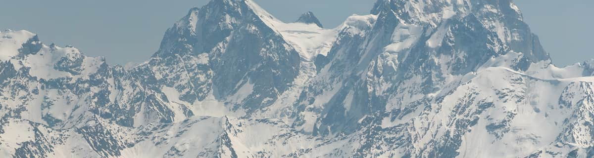
Popocatepetl is a volcano with forested slopes and a snow-capped cone and large crater. It is the second highest peak in Mexico at 17,887 feet (5452 metres) behind Pico de Orizaba at 18,405feet. The name Popocatepetl is Aztec for Smoking Mountain, and is often, conveniently, shortened to Popo. Popo and its neighboring volcano Iztaccihuatl (17,342 feet.) dominate the sky southeast of Mexico City. They are located less than fifty miles from the city, and are separated from each other by a ten mile ridge. Popo's last major eruption was in 1947, although on December 21st 1994, it awakened from dormancy, spewing gas and ash, which was carried by the wind as far as Puebla, 25 miles east. Surrounding towns were evacuated, and scientists have since been closely monitoring Popo for signs of a possible eruption. The first recorded ascent of Popocatepetl was by the Tecuanipas tribe in 1289. The first Spanish ascent of the mountain was an expedition led by Diego de Ordaz in 1519. Emperor Moctezuma sent ten warriors to climb the mountain sometime between 1502 and 1519. Only two of these warriors survived the climb.
Εξερευνήστε τον χάρτη τοποθεσίας του Popocatepetl
Διαδραστικός χάρτης μονοπατιών και πίστας Popocatepetl. Προβάλετε την πίστα και τα μονοπάτια, καθώς και τα γύρω εδάφη και ορεινά περιγράμματα για δράση στην εξοχή. Βρείτε και συγκρίνετε κοντινά θέρετρα με κλικ στους δείκτες θέρετρου.

Ποιος είναι ο μήνας με το περισσότερο χιόνι στο κέντρο Popocatepetl;
Πώς είναι το χιόνι τώρα στο Popocatepetl?
Σύνοψη των συνθηκών χιονιού που ισχύουν αυτήν τη στιγμή στο Popocatepetl. Βρείτε περισσότερες πληροφορίες στο Popocatepetl σελίδα αναλυτικού δελτίου χιονόπτωσης.
- Κατάσταση πίστας—
- Κατάσταση εκτός πίστας—

| Υψος Χιονιού Κορυφής: | ||
|---|---|---|
| Υψος Χιονιού Βάσης: | ||
Κριτικές επισκεπτών για Popocatepetl
Ο/η Taylor Ramsay από United States γράφει:
I cannot seem to find any information on how to ski at Popo or where there might be lifts. I read the most recent comment here from El Pico de Orizaba and felt hopeful, but I cannot find any further information. Does anyone have any more info?
Χιονοδρομικά κέντρα κοντά στο Popocatepetl
Ανακαλύψτε χιονοδρομικά κέντρα κοντά στο Popocatepetl. Κάντε κλικ παρακάτω για να δείτε οδηγούς για χιονοδρομικά κέντρα.
 Ski ApacheΤελευταία χιονόπτωση: 1.0 cm Sat 02 May
 Αναβατήρες: 11
 Πίστες: 551732 km μακριά
- Mount Lemmon Ski ValleyΤελευταία χιονόπτωση: 2.0 cm Mon 09 MarΑναβατήρες: 3Πίστες: —1923 km μακριά
- Sandia PeakΤελευταία χιονόπτωση: 1.0 cm Tue 05 MayΑναβατήρες: 7Πίστες: 251955 km μακριά
- Sunrise Park ResortΤελευταία χιονόπτωση: 3.0 cm Tue 05 MayΑναβατήρες: 10Πίστες: 651983 km μακριά
- Ski Santa FeΤελευταία χιονόπτωση: 1.0 cm Tue 05 MayΑναβατήρες: 6Πίστες: 671984 km μακριά
 Nearest